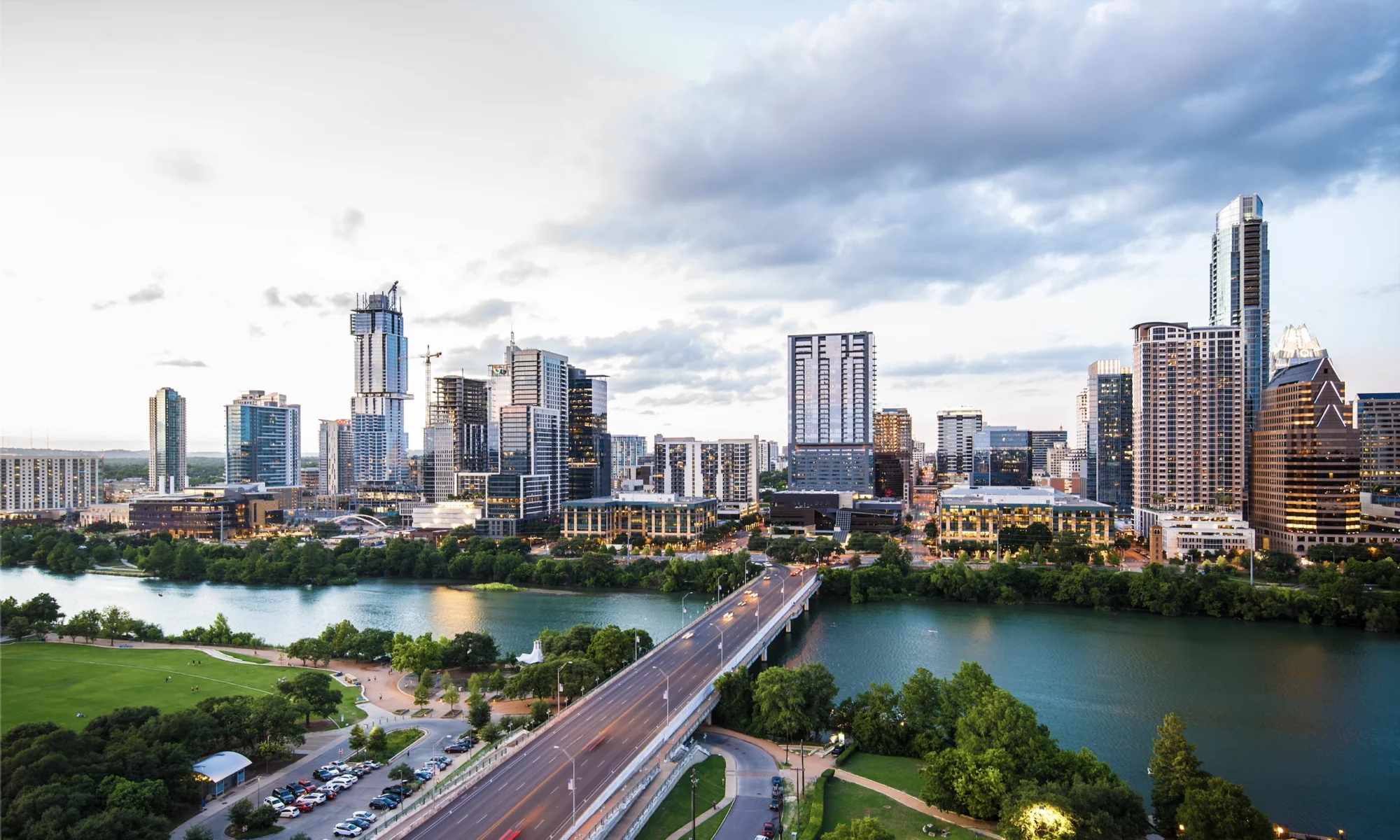
In line with AURA’s Platform for Austin, we expect that the items below will be seriously considered by staff and consultants while writing and mapping CodeNEXT. If AURA does not see substantial progress on most or all of these items, we will have no choice but to oppose the adoption of staff’s recommendations for CodeNEXT.
Small Area Plans are No Way to Plan a City // Neighborhood Plans, TODs, and corridor plans enable the most active minority to impose their will on a small area and shift all the external costs onto the rest of our city. That’s no way to plan a city, and the entire premise has been rendered redundant by the recent move to a geographically representative city council. CodeNEXT must shift from honoring the exclusionary small-area plans of our past to empowering a future for our entire city.
Dynamic Upzoning with Incremental Development // When an area is more than halfway to its maximum zoning capacity, the code should contain an automatic administrative procedure to increase that capacity. This process is similar to how cities have evolved naturally for centuries. We should future-proof our code and avoid continuing our current, highly contentious, lot-by-lot approach which favors the status quo.
Fair Housing and Household Affordability // Our new code must permit the population in our high-demand areas to respond to that demand. Every neighborhood must accept new residents and further Fair Housing. Staff should create Affordability Impact Statements which examine how the new code and its mapping further Fair Housing and contribute to Household Affordability, taking into account not just the cost of housing, but the costs of transportation.
Significantly Reduce or Eliminate Minimum Lot Size // Minimum lot sizes are an attempt to address wide-area issues by regulating an individual lot. Our minimum lot size is larger than any peer city in Texas and increases the cost of housing. We call for a minimum lot size of 1000 square feet, and reducing the minimum lot width to 15 feet.
No Unit Caps // Our current code limits the number of units that different kinds of zoning can have. We believe a detached building that contains multiple units but looks like a single-family home should be allowed in an area zoned for single family. Similarly, minimum site areas for multifamily zones impose a de facto tax on small, affordable, apartments. The code should govern the built environment, not the people who live within it.
Urban Core Zoned to No Less Than T-4 // The city of Austin has an established definition for the “urban core,” and has enacted policies such VMU and reduced parking burdens within those boundaries. As CodeNEXT will use a transect model, and the lowest transect suitable for urban spaces is T-4, “General Urban,” all developable land within the defined urban core should be zoned for at least T-4.
End Compatibility as Currently Practiced //Setbacks and height limits are our current attempts to regulate compatibility between varying uses. We should eliminate compatibility based on use, and understand that the nature of using transects manages “compatibility” automatically. Currently, compatibility requirements constrain lots in high-demand areas and prevent the development of needed housing.
Significantly Reduce or Abolish Parking Minimums // The Code Diagnosis found that we have a car-centric code, which encourages car usage and exacerbates our current traffic woes. Reducing or eliminating parking space obligations won’t mean that none are built — just as many as the perceived demand is. Consider adopting parking maximums to discourage the excessive construction of expensive parking structures which may be orphaned in the future.
Connectivity Required Everywhere // Revise the subdivision code to require integration of new subdivisions into the larger urban fabric. Reduce maximum block length and revise street design standards so that the most vital of public infrastructure serves all users, not just single occupancy vehicles. Conduct an audit of all Austin streets to determine areas of poor connectivity, develop a “Future Connectivity Map,” and produce an associated plan for implementation.
Replace Impervious Cover Regulations with Limits on Urban Runoff // Flooding is caused by runoff, not impervious cover, yet our code tightly regulates impervious cover in an attempt to mitigate flooding. Limitations on impervious cover are, at best, a highly imperfect proxy for potential runoff, and stifle creative solutions that may reduce runoff while permitting greater impervious cover. As such, blanket limits on impervious cover (and building cover) should be replaced with performance standards for maximum permissible urban runoff.
AURA’s CodeNEXT expectations were first shared with CodeNEXT staff in December 2015.
The Mayor and City Council recently endorsed a bond proposal for $720 million addressing mobility concerns across the city. The mix of funding in question follows the chart below:
Category
Amounts
Notes
Regional Highways
$101,000,000
Loop 360, Spicewood Springs, Parmer, et. al.
Corridor Plans
$477,500,000
N. Lamar, Burnet, Riverside, Airport, FM 969, S. Lamar, Guadalupe
New Corridor Planning
$4,500,000
Sidewalk Master Plan
$55,000,000
Urban Trails
$30,000,000
Trails for both cycling & pedestrians
Bicycle Master Plan
$20,000,000
Vision Zero Safety
$15,000,000
Substandard Roads
$17,000,000
Falwell Ln, Meadow Lake Blvd, William Cannon Bridge, et. al.
Although this includes money for the Sidewalk Master Plan, it fall far short of the proposals of the plan itself, and far short of what advocates were asking. The Sidewalk Master Plan itself proposed $25 million per year for new sidewalks, enough to fund most high priority sidewalks over a period of 10 years. This plan would fund only two years and a bit of that amount. Since most bonds are anticipated to be spent over a period of at least 3-5 years, this plan starts out with undervaluing the importance of sidewalks to safety and to a vibrant city life. It sells short the promise of the Americans with Disability Act, under which more than one city has been successfully sued because of a lack of sidewalks. In short, this proposal does not do enough to tackle one of the most significant mobility needs we have – lack of accessible sidewalks.
Unfortunately, an already underfunded plan was further gutted by an amendment offered by Councilmember Sherri Gallo and adopted by the council, splitting that $55,000,000, half to the priorities laid out in the Sidewalk Master Plan and half split evenly between districts. To get into why this is such a bad idea, a little more about how the Sidewalk Master Plan makes its priorities is necessary.
The Sidewalk Master Plan first mapped all of the “absent” sidewalks throughout the city. It found more than $1 billion worth of need. It then used a matrix to score each sidewalk segment, using a complex mix of factors including number of people nearby, proximity to schools, grocery stores, safety issues for pedestrians, income, and many more factors (for the full list, go to page 10 of the pdf). This plan received extensive public vetting – in community meetings across the city, at various boards and commissions, and at city council itself. While no weighting system can please everyone about everything, the scoring does a good job of prioritizing low-income areas, areas around schools, areas with significant pedestrian safety issues, and areas around transit. Historically neglected neighborhoods in East and North Austin would receive a large portion, and areas with large numbers of people, schools, and often used buildings in Central Austin also receive priority.
Apparently, this stride towards equity and helping the most in need was not good enough for the city council. By taking half of the funding and spending it geographically, regardless of need, regardless of historic disinvestment, they have struck yet another blow against inclusivity and justice. For one example, District 1 in East Austin, which had many of the high priority sidewalks, will see $4 million less under Councilmember Gallo’s amendment than it otherwise would have received. Yet again, relatively well-off west Austin neighborhoods will receive more than their share of public funding and investment, and historically neglected areas of Austin will continue to languish for years more without safe routes to schools, unsafe roads, and inaccessible transit.
This post is part of a series on Imagine Austin’s priority programs, in light of Austin’s current CodeNEXT rewrite process. View the entire series here.
What is a zoning code, or land development code? It is a set of rules determined by a city that says what can be built, and what categories different pieces of land fall into. Many zoning codes restrict what types of uses each category can have. For example, “LI” means “Light Industrial” and can be used for various industrial purposes but cannot be used for commercial purposes (like a store). Zoning came about to protect people from living next to smelting plants and uses that might impact health.
CodeNEXT is the new form-based code (more focused on the looks than the uses) zoning program initiated by the approval of the Imagine Austin Comprehensive Plan currently being developed by city-hired consultants (Opticos Design) and Planning and Zoning Review city staff, led by Program Manager, Jim Robertson. The goal is to simplify the current zoning code with tools (for example: missing middle housing, small area plans, and transects) to better fit form, texture, and context while suiting the needs of residents, neighborhoods, and businesses alike. To ensure the public’s participation in this process, Austin City Council approved a public feedback process which is currently ongoing.
The City of Austin’s Land Development Code Advisory Group (CAG) is composed of Austinites from all 10 Districts tasked to review and make recommendations to Austin City Council regarding the initial release of CodeNEXT in January 2017. Currently, the CAG is discussing code prescriptions regarding some of the community’s most pressing concerns including (recently released) Household Affordability, Natural and Built Environment, and (coming soon) Mobility, and Fiscal Health.
For the new form based code to be successful, CodeNEXT must incorporate such actions as zoning mapping that is city-wide with the implementation of new zoning tools applied to all neighborhoods. To reserve household affordability, the minimum lot size must be narrowed along the street width to accommodate greater population. New neighborhoods and infill developments must be designed for pedestrian traffic as the priority over automobiles. These goals are also in alignment with the city’s transit goals, including COA’s Vision Zero program for greater pedestrian safety. Not only that but they are key to implementing the other 7 priority programs of Imagine Austin, described in the rest of our series.
In the 20th Century, Austin’s zoning history has been one of runaway suburban-style growth to the present day where the city now resides in Travis, Williamson, and Hays counties. This exponential growth now threatens to endanger the city’s balance of community and connection as suburban texture negates social interactions for homestead isolation. It threatens our precious natural resources by forcing people to drive further distances to get to work or do daily errands. In the 21st Century, reinforcing and reintroducing urbanist principles through CodeNEXT is the only way to preserve Austin’s character expressed in our culture, people, and businesses.
In order for CodeNEXT to fully embrace the growing and affordability challenges facing Austin, the CAG must hear from you. Land Development Code Advisory Group meetings are scheduled for the first Monday of the month at 6:00PM. Please give ideas, feedback, and suggestions on their forum sponsored by the City of Austin at Speak Up Austin.Imagine Austin priority programs series
IMAGINE AUSTIN PRIORITY PROGRAM 6: CREATE A HEALTHY AUSTIN
This post is part of a series on Imagine Austin’s priority programs, in light of Austin’s current CodeNEXT rewrite process. View the entire serieshere.
There is increasing evidence that moderate exercise, like walking, can extend life expectancy and reduce chronic disease. In many places around the world people get their recommended 10,000 steps, or 30 minutes of walking, simply by going about their daily lives. That might include walking to the bus, running errands by bike, strolling to the park, etc.
What would Austin look like if we could get our daily exercise simply by going about our daily lives?
Most of Austin was built around the assumption that people would be driving. To image a more connected Austin look at our older neighborhoods, where we still have the smaller, connected streets and a mix of uses that make walking, biking, scootering, etc. a safe and easy way to get around.
Think about Hyde Park, where I grew up, with its tree-lined streets, compact blocks, and destinations within the neighborhood. Long before I was old enough to drive I could get myself to the post office, grocery store, coffee shop, video rental (yes, pre-NetFlix), park, swimming pool, museum, bus stops, and a variety of restaurants. That is not possible in most neighborhoods. Newer neighborhoods typically have sidewalks along every street, but non-residential uses like shops, restaurants, and community services tend to be located far away, surrounded by parking lots. And bus service is very difficult to provide when housing is spread out along streets that do not connect.
We have the opportunity to improve public health by creating a city that is compact and connected, where people can walk, ride bikes, or roll to the places they want to go. In the recent Mobility Talks survey 76% of Austinites said they travel alone in their car, but almost the same number (74%) said they wished they had better options to bike, walk, or ride public transportation. Can you imagine what it would be like to walk to dinner with your family?
All Austinites should have easy access to healthy food, medical care, and services.
To do that we need to connect neighborhoods to amenities and transportation options. The City of Austin has made progress putting sidewalks, ADA accommodations, and bike lanes on the ground, while planning for more. We have a Sidewalk Master Plan, which shows we have $1 billion in missing sidewalks and $15 million/year needed to repair existing ones. We have some Pedestrian Hybrid Beacons, but many roads still do not have safe places to cross, sometimes for more than a mile!
Our current sidewalk program is out of money. We can build sidewalks around every school, park, and transit stop, but only if we make that vision a priority.
We have a Bicycle Master Plan, which envisions a connected network of on and off-street (urban trail) bike facilities, but we need $150 million to build it. We have some transit, but people often note they want more frequent transit to get where they are going reliably.
Many Austinites are already walking, biking, rolling to their destinations, but without a connected network (sidewalks, bike lanes, and transit all working together) those trips are difficult and often dangerous. In 2015, 102 family members, friends, and co-workers died on Austin’s streets, 1/3 of them were pedestrians. 2015 was our most dangerous year to date on Austin’s roads, but 2016 is shaping up to be just as heartbreaking. Recently a 3 year old child was run over and killed while crossing Cameron Road (in a crosswalk) with his family. A week later, a 14 year old boy was hit and killed while riding his bike on Spicewood Springs Road.
Our children should not be dying on our streets.
Our City Council has adopted a Vision Zero policy which notes that traffic crashes are preventable and any death on our streets is too many. It’s an adopted goal of Imagine Austin and needs to be implemented.
We can continue to encourage people to make transportation choices that improve their health, but as long as people are dying on our streets that is a hard sell. Imagine Austin envisions a healthy Austin where all community members have safe and healthy ways to get to services, healthy food sources, and medical care.
Our transportation network should be built for all ages and abilities in a way that promotes healthy living and provides equitable access for all. While Austin has made much progress in adopting policies, we still have a long way to go until we see results.
This post is part of a series on Imagine Austin’s priority programs, in light of Austin’s current CodeNEXT rewrite process. View the entire series here.
Everyone hears about how many people are moving here each day as well the booming technology economy, but what about the residents already here who might not have those particular skills? The Workforce and Education priority is all about ensuring that our communities thrive by building up the skills of workforce, investing in small businesses, and investing in our schools.
In the four years since the adoption of Imagine Austin, a lot has changed. More businesses have moved to Austin, more entrepreneurs have started their own businesses, and the city has sought to encourage and help these businesses thrive. A few highlights in this area:
OPENING OF AUSTIN COMMUNITY COLLEGE HIGHLAND CAMPUS
This is an incredible milestone for our city. ACC Highland opened in August 2014 amid great fanfare. They took a defunct mall and turned it into a beautiful space for learning and business incubation. It is the home to a “math accelerator” which provides 604 computer workstations for students to drop in and work on homework, or to take courses at their own pace. It is staffed by tutors who are available to help students who are stuck on problems. It is also home to a partnership with major employer Rackspace to open new offices as well as provide internships to ACC students.
LOCALLY AUSTIN APP
An App was created to encourage residents and visitors alike to explore local small businesses. It provides suggestions based on location and keyword search. Within the App are also links to resources to help small businesses learn about marketing, mentoring, business plans, and financial details of starting a business. Small businesses can list their business free of charge and connect to resources easily.
LIBRARY PROGRAMS
Throughout the city, hundreds of people have attended programs to learn how to use computers, gain job skills, and learn how to start a business.
INDUSTRY REPORTS
The economic development office has undertaken significant reports on the music industry as well as the fashion industry to better understand how they impact the economy as well as the challenges they face. You can read more here and here.
We applaud the efforts of the city to increase opportunities for all Austinites, in particular those without the skills to be most successful in the 21st century economy. We also agree that the benefits to Austin are HUGE from small businesses. If you spend $100 at a local business, $68 stays in Austin. If you spend the same amount at non-local business, only $43 stays in Austin. Keep up the good work Austin, and shop local!Imagine Austin priority programs series
On Tuesday, the Planning Commission will consider changes to the carport exemption for McMansion. We encourage the Planning Commission to not think small, and instead make serious reforms to the regulations.
Subchapter F, better known as the McMansion Ordinance, has placed limitations on the floor to area ratio (FAR) of new homes built in Austin. According to the McMansion Ordinance, the allowable FAR for a home is calculated using lengthy and complicated sets of exemptions. While these FAR requirements were originally devised to regulate massing and scale, they have failed to result in meaningful design improvements, and in fact have substantially harmed design, aesthetics, and the development process.
Years after Subchapter F was enacted, the city found itself in litigation over the ordinance’s complicated “attic exemption” and had to issue memos clarifying the requirements. A decade after being enacted, other exemptions continue to cause problems—specifically, the carport exemption and its confusing distinction between what constitutes a carport and what constitutes a garage.
AURA does not support perpetuating this confusion with layers of fixes to Subchapter F’s inherently flawed concept of space. Rather than further complicate matters, AURA asks that the City scrap the whole concept we’ve tried for the last ten years without success, and do away with FAR restrictions entirely.
Having FAR limitations, in addition to building coverage, limited building height, large setbacks,excessive parking, and additional residential design requirements is unnecessarily duplicative. Practically, only so much FAR is mathematically possible within the constraints of the McMansion tent, building height, and setback requirements. Therefore, Austin should simplify its land development code.
Austin has very burdensome zoning requirements for single-family lots. Austin zoning maps show huge swaths of yellow lots where only detached single family construction is allowed. A multitude of “yellow lot laws” serve to perpetuate the economic segregation of Austin. Given the large minimum lot size required in single-family zones, an increasing number of our citizens can’t afford to move into “yellow lot” areas—that is, the majority of the land in the city! Not only do we require large lots, we limit these large lots to very low density. By limiting the amount of habitable space even further via FAR requirements we have effectively put a very high premium on housing and we are manufacturing scarcity. AURA believes it is time to scrap this approach and embrace all types of housing attainable by all types of people in all areas of the city.
Furthermore, as the carport exemption is centered on the issue of off-street parking and because FAR makes parking compete with habitable space, AURA also calls for the abolition of off-street parking minimums. Removing off-street parking minimums does not prohibit the market from providing off-street parking where there is perceived demand. But it will allow the market to stop eating away at housing space for people where the market may choose people over parking. Homes with fewer parking spots can result in less impervious cover, healthier citizens, better affordability, and more feasible mass transit options.
We’d also like to show a couple of blog posts on an alternative to McMansion that is mostly illegal in the city—row houses. See Part One and Part Two. Finally, last year, AURA also called for significant reform to Subchapter F, in light of the huge cost of compliance for the city. With that said, we are also in favor of incremental reform, such as eliminating FAR.
There are other major problems with the McMansion Ordinance. The ordinance is single-family home centric and does not accommodate duplexes, triplexes, fourplexes, row homes, and other missing middle housing options. The McMansion Ordinance will not apply correctly to a compact and connected development pattern moving forward. The ordinance is ridiculously complicated for the city to manage at the staff review level as well as the code enforcement level. It adds precious time to the process, when we should be working to provide housing more quickly. The ultimate result is a slower supply line for housing, and increased costs for the housing that does come to market. With all this in mind, AURA calls for Austin to move away from a housing policy regulated via Subchapter F.
This post is part of a series on Imagine Austin’s priority programs, in light of Austin’s current CodeNEXT rewrite process. View the entire series here.
Imagine Austin discusses the importance of integrating nature into the city as the benefits of open space and nature are well-documented and widespread. Austin has always been a bit more “green” than the rest of Texas and many Austinites treasure the numerous parks and greenspaces throughout the city. As such, Imagine Austin called for a focus to preserve and protect this critical part of who we are. Green infrastructure throughout the city is one important way we can do that.
A great approach to green infrastructure planning is to think about it at the city-level, not just the site level. By investing in our city and growing our tax base, we can afford municipal infrastructure improvements like the Waller Creek Flood Tunnel, which will open up more of the former flood plain to development by redirecting floodwaters under ground. Waller Creek itself is a great example of green infrastructure. By connecting parks to each other via trails and great creek-facing experiences, the Waller Creek Conservancywill develop amazing infrastructure that will improve the city for decades to come.
meanwhile, approaching green infrastructure on a site specific basis can lead to problems. For example, in most parts of the city (except the Lake Austin overlay), the city has a standard impervious cover limitation. However, it may be appropriate to consider topology of the surrounding area as part of impervious cover limitations. For example, a steeper slope might allow less impervious cover than the standard, and a relatively flat area may allow more. Investing in drainage in areas where we want to encourage density may be a better approach than restricting site area on a site-specific basis. Finally, the easiest solution is to to allow more height on the same “footprint” of land. Instead of only allowing a 2 story building, a 4 story building doubles the density while maintaining the footprint and impervious cover. A four-story building remains “human scale” and can even provide shade to the sidewalk for those hot summer days.
Parkland is another critical issue for the city that should be reconsidered as we develop CodeNEXT, another critical part of Imagine Austin. The Council recently instituted a 15% cap on the amount of land that can be required to be dedicated as parkland when a site is developed. This balanced approach allows for more housing, offices, and other uses that can then create new users of that park. Parks are a critical feature of our city – and we should allow more people to live near them to increase their accessibility.
Green infrastructure is just as important on our streets. Shade trees, benches, and landscaping can improve the pedestrian experience and even narrow lanes. Narrower lanes increase safety for all road users (drivers, pedestrians and cyclists) by slowing cars down. It also improves the experience of walking or cycling when cars aren’t flying by you at 45 miles per hour. A great milestone for all of Austin is the adoption of a “Complete Streets” policy in 2014. It calls for making all of our streets more inviting to users and includes many green infrastructure elements.
In a city known for its rapid growth and for its tendency to flood, Austin needs to acknowledge that we have to solve for both problems – and a growing tax base to pay for more infrastructure is a better alternative than pushing growth out into undeveloped land outside the city limits. Tragically, some of the worst flooding in recent memory has happened in *less* developed areas like Wimberly, with horrific loss of life and property. By encouraging sustainable growth based on data from the latest in ecological research, we can make a city that is greener and safer for all.Imagine Austin priority programs series
his post is part of a series on Imagine Austin’s priority programs, in light of Austin’s current CodeNEXT rewrite process. View the entire series here.
“The possible disappearance of live music venues, art spaces and other Keep Austin Weird-type businesses in favor of mixed-use condominium developments could undermine the city’s reputation as a creative hub, which helped fuel its growth in the first place.”
Austin Business Journal (April 2015)
“Failure to address affordability endangers the economic security of us all. A sizable segment of Austin’s economy and the city’s brand is based on the entertainment industry. Businesses attract new talent based on the city’s reputation, whether their core products are semiconductors or homes.”
In 2012, Imagine Austin anticipated two key challenges to the future of our city’s multibillion dollar creative economy:
Affordable, accessible, and functional studio, performance, rehearsal, and office spaces for small organizations and individual artists.
Affordable residential units and transportation options for artists and creatives as housing costs and land values in the urban core rise.
Numerous studies commissioned by the city as well and research conducted by independent nonprofit organizations like Austin Music People have validated these predictions, as well as what many Austinites already knew from hard personal experience: our local artists and creative industry workers are among the many citizens finding it more and more difficult to live and do business in a city that is increasingly becoming unaffordable for middle- and lower-income workers.
Downtown development of relatively expensive condos and apartments are pushing low and middle-income artists and creative industry workers further out of the central City core. Anecdotal evidence suggests that many of these individuals are beginning to move out of Austin altogether due to the cumulative effect of affordability issues.
The Imagine Austin plan identified other challenges as well: the importance of using arts and creativity to build community and strengthen Austin’s multicultural identity; the lack of access to arts and creative resources experienced by specific populations; the need for workforce development geared toward the creative industries from elementary school programs to opportunities for adult learners.
The Imagine Austin plan noted that “collecting consistent and thorough data on a regular basis is important to measuring the plan’s progress.” To that end, a baseline was calculated for the seven different Complete Communities Indicators tied to this priority:
Dedicated municipal finding for arts (dollars per capita)
Private funding for arts (dollars per capita)
Arts programs in schools and neighborhood recreation centers
Attendance at arts/cultural events
Money brought into economy from arts/cultural events
Live music venues
Households within 1/2 mile distance of art/cultural venue (percent)
At this time, no updated data on these metrics has been provided by City staff to document whether progress has been made in the last four years. However, independent research, such as the economic impact study commissioned by Austin Music People from TXP Inc. in February 2016, indicate areas of continued concern: for example, in the space of four years, Austin’s internationally-lauded commercial music sector lost 1,200 jobs.
Some efforts to reverse the trend of creative stress—and ultimately, flight—have been made. In March 2016, City Council approved Mayor Adler’s Music & Creative Ecoystems Omnibus Resolution, which directed the City Manager and staff to come up with a plan to stabilize and develop this critical sector of our regional economy. The staff report on this resolution is presently overdue but, assuming it is delivered to Council shortly, action could be taken as soon as late June 2016, allowing for new and/or streamlined initiatives to be considered in budget conversations for the new fiscal year. Priorities to be addressed in the omnibus include affordable space, health and educational services, industry and professional development, and city regulations, operations, and incentives—all of which are intentionally aligned with both the Imagine Austin priorities as well as with a variety of Complete Communities Indicators.Imagine Austin priority programs series
his post is part of a series on Imagine Austin’s priority programs, in light of Austin’s current CodeNEXT rewrite process. View the entire serieshere.
Prior to Imagine Austin, it was clear that this city had a long way to go before it could be considered to be even a little bit “compact and connected.” Outside of the few square miles of old Austin, much of this city had been laid out as though it was one massive suburban subdivision—with low-density housing and disconnected streets dominating the landscape.
When Imagine Austin was developed, the idea that our city might be at all compact and connected seemed like a bit of a pipe dream. We’ve gone so far down the road of building a sprawling, disconnected car-based suburb, it’s hard to imagine how to get better. Since 2012, there have been a few really positive developments:
Completion of the Ladybird Lake Boardwalk: The hike and bike trail along Ladybird Lake has long been one of the nicest things about downtown Austin, and filling in the boardwalk has re-connected two sections of this trail that have long been disconnected, turning it into one large, continuous loop around the center of town.
Attribution: Free Fun in Austin.com
Re-connecting the Grid West of Downtown: With the Seaholm Development and the 2nd Street District, the western part of downtown is on its way to having a connected grid for the first time in decades. Though the bike and pedestrian access along Cesar Chavez west of Lamar could be so, so much better, it has already improved tremendously in the past four years. Once the Seaholm development is completed and West Ave goes all the way through to Cesar Chavez, we can expect that to get even better.
Various Infill Projects: The city’s Compact and Connected team cites several infill projects that demonstrate a significant effort to build compact and connected infrastructure. Either by improving the sidewalk, or building densely close to transit or other amenities, these projects have helped make our city easier to get around.
At the same time, we have a great deal to improve in order to reach the goal of growing as a compact and connected city, where getting around by car isn’t the only option.
First of all, way too much of our city’s growth is occurring in places with no transit, sidewalks, or really any kind of accessibility outside of single occupancy vehicles. From 2000-2010, the population in the most central neighborhoods declined while those neighborhoods on the outskirts essentially exploded—and there’s very little reason to expect that this trend has reversed itself in the last five years.
Additionally, though Austin proper is the fastest-growing big city in Texas, its growth rate is actually being outpaced by growth in San Marcos, Cedar Park, Pflugerville, and Georgetown. Though we can’t necessarily stop development in the suburbs, we have to admit that all the population going there isn’t at all good for us—and it’s certainly disastrous for compact and connected. It’s not hard to imagine that some percentage of the people moving to Pflugerville would rather be in Austin. We need to find a way to get those people closer to downtown if we want to do anything at all about decreasing vehicle miles traveled. Many people in the suburbs are still driving into Austin every day, using our streets but not paying taxes for them, and increasing traffic congestion and pollution at the same time. Making it easier to build urban infill projects in parts of town that are already well-served by infrastructure and transit is a start.
Attribution:Sustainable Prosperity
Also, we need to stop building gates on public streets, and we need to stop fighting street connections. A connected street grid is absolutely essential if we’re going to have any hope of making this city more accessible on foot or on bike. We can’t keep relying on high-traffic roads to get people from point A to point B and expect that anyone will voluntarily choose to do anything other than drive. This means building street connections in neighborhoods wherever we can, and making those connections peaceful, safe, and inviting for pedestrians and cyclists.
Which street would you rather be on with your elderly grandmother? With your children?
On the fourth anniversary of the adoption of Austin’s comprehensive plan, Imagine Austin, let’s take amoment to review what the plan is, how it came to be, how it relates to the CodeNEXTeffort to revise the land development code, and how we measure success in implementing it.
What Is a Comprehensive Plan?
A comprehensive plan is a long-term vision for a city that guides all policy decisions. Comprehensive plans are high level; they don’t prescribe policies or land use on a parcel-by-parcel or neighborhood-by-neighborhood basis.
How Did We Create Ours?
Starting in 2009, I was one of about 40 Austinites who oversaw the development of the Imagine Austin as members of the Citizens Advisory Task Force (CATF) for the comprehensive plan. Our role was to engage the community to understand its needs, promote public participation, and shape a vision for Austin’s future.
Growth scenarios were a key part of the development of Imagine Austin. Under the premise that Austin and its extraterritorial jurisdiction (ETJ) would grow by 750,000 residents and 300,000 jobs by the year 2035, the community engaged in a process to determine how that growth would occur in the most sustainable fashion.
City staff and CATF members invited the community to participate in “chip exercises”, wherein members of the public placed chips on maps of Austin to indicate where growth should go. City staff grouped and combined the growth maps into four growth scenarios. A fifth “trend” growth scenario, depicting how Austin would grow without changing its policies, accompanied the four community-inspired growth scenarios.
To determine the community’s preferred growth scenario, staff posted each of the growth scenario maps at workshops throughout the city. A set of “sustainability indicators” accompanied each map. For each growth scenario, the city quantified the outcomes that would occur on such indicators as vehicle miles traveled (VMTs), transit ridership, cost of public infrastructure, and water consumption.
By quantifying the impact of the growth scenarios, the indicators informed the public conversation and decision about which scenario was the most desirable. The public ultimately voted in the largest numbers for scenario D, which directed most of the jobs and people into the central city. Imagine Austin includes a “growth concept map” based on scenario D, while incorporating elements of scenario C and minor adjustments to reflect certain land use constraints.
Beyond the selection of a growth scenario, through a series of workshops, community forums and conversations, and other outreach efforts, city staff, consultants, and CATF members solicited 18,000 public inputs and meticulously categorized and considered each input during the process of drafting the plan. Austin’s City Council unanimously approved the plan on June 15, 2012.
What’s In Imagine Austin?
The Imagine Austin plan contains several key concepts that can be confusing, including:
1. Complete Communities and Goals
2. Core Principles for Action
3. Policy Areas and Building Blocks
4. Priority Programs
Imagine Austin’s vision is for complete communities throughout the city. A complete community is:
1. Natural and sustainable
2. Prosperous
3. Livable
4. Mobile and interconnected
5. Educated
6. Creative
7. Values and respects people.
These attributes of complete communities are the goals of Imagine Austin.
To achieve these goals, the plan outlines six core principles for action:
1. Grow as a compact, connected city.
2. Integrate nature into the city.
3. Provide paths to prosperity to all.
4. Develop as an affordable and healthy community.
5. Sustainably manage water, energy, and environmental resources.
6. Think creatively and work together.
Ultimately, policies in the following policy areas must work in concert to apply these principles and achieve plan goals:
1. Land Use and Transportation
2. Housing and Transportation
3. Economy
4. Conservation and Environment
5. City Facilities and Services
6. Society
7. Creativity
To facilitate implementation and match the departmental structure of the City of Austin, the plan enumerates eight priority programs:
1. Invest in a compact and connected Austin
2. Sustainably manage our water resources
3. Continue to grow Austin’s economy by investing in our workforce, education systems, entrepreneurs, and local businesses
4. Use green infrastructure to protect environmentally sensitive areas and integrate nature into the city
5. Grow and invest in Austin’s creative economy
6. Develop and maintain household affordability throughout Austin
7. Create a Healthy Austin Program
8. Revise Austin’s development regulations and processes to promote a compact and connected city.
It’s important to recognize that Imagine Austin’s core principles for action and priority programs are principles and programs intended to achieve plan goals, but they are not, in and of themselves, the goals.
Compact and Connected
The first and last of Imagine Austin’s priority programs are “bookends” and reflect the plan’s emphasis on moving towards the denser development patterns the public chose in growth scenario D. Priority program #8 gave birth to the CodeNEXT process, which is the city’s effort to revise the land development code to achieve the goals of Imagine Austin.
Indeed, Imagine Austin links compact and connected development patterns to many of the plan’s goals:
● “More compact growth . . . enhances human connections, innovation, and urban vibrancy.” – Page 10
● “The per unit costs associated with serving low-density, sprawling development with water and wastewater services are generally greater than those associated with denser, more compact development.” – Page 61
● “By promoting a compact and connected city, Austin seeks to direct development away from sensitive environmental resources, protect existing open space and natural resources, and improve air and water quality.” – Page 97
● “A compact community is one in which housing, services, retail, jobs, entertainment, health care, schools, parks, and other daily needs are within a convenient walk or bicycle ride of one another. A compact community is supported by a complete transportation system, encourages healthier lifestyles and community interaction, and allows for more efficient delivery of public services” – Page 129
● “Well-designed compact areas with plenty of people, workplaces, and multifamily homes make transit work; they’re needed to make frequent, convenient bus and rail service viable . . . . Per person, compact urban areas have a lower carbon footprint than suburban areas. More compact development patterns [also] lower taxpayer costs for public services, if fewer roads, water and sewer lines, power lines, and other infrastructure are needed to serve far-flung places. Encouraging compact infill projects also reduces development pressures on open space around Austin, helping to support land conservation and environmental protection.” – Page 129
Compact and connected development patterns impact the concept of “household affordability”, mentioned in priority program #6 and a component of the “livable” attribute of complete communities. The Imagine Austin task force deliberately chose the “household affordability” term to refer, not just to the cost of housing, but to the combination of housing, transportation, and utility costs.
The cost of land – and, therefore, housing costs – in outlying areas tend to be lower than in high-demand areas in the central city. But people who live the outlying areas often experience much higher transportation costs. The appendix of the 2014 Austin Comprehensive Housing Market Analysis shows that, in some Austin zip codes, households’ transportation costs are nearly as high as their housing costs. Policies that might yield greater housing affordability, in isolation, differ from those that yield greater household affordability.
Thus “compact and connected” is not one of many goals but is key among the core principles and priority programs designed to achieve Imagine Austin goals.
Complete Communities Indicators
As the city implements Imagine Austin and continues the CodeNEXT process to revise the land development code, how can we know we’re headed in the right direction?
Imagine Austin answers this question with a set of “complete communities indicators”. Page 224 of the plan states that these indicators “measure success in achieving plan goals”. The 58 indicators, listed on pages 225-226 of the plan, are organized by the attributes of complete communities. They include such indicators as:
● Cost burdened households (housing, transportation, and utility costs)
● Vehicle miles traveled (total and per capita)
● Water consumption (total water use and per capita residential)
● Households within ½ mile distance of park or accessible open space (percent)
Policy and land development code changes that move the complete communities indicators in the wrong direction fail to achieve, or undermine achievement of, Imagine Austin goals.
To measure progress, the plan calls for the city to monitor and update these indicators, and that “measures and reporting should be highly visible to promote accountability”.
Yet the indicators also can provide guidance, in advance, on which policies the cities should adopt to achieve plan goals. Much as “sustainability indicators” guided the selection of a preferred growth scenario during the development of the Imagine Austin plan, the complete communities indicators can guide CodeNEXT decisions and Imagine Austin implementation.
The city has a license for, and access to, a software tool, Envision Tomorrow, that enables staff to input various factors and determine their effects on the indicators. As the CodeNEXT team proposes revised land development regulations and maps them to neighborhoods across the city, they can explore several different scenarios and use Envision Tomorrow and other tools to estimate and quantify the impact on the complete communities indicators.
Summary
The Imagine Austin plan provides the long-term vision and goals for our city: a city of complete communities that are natural and sustainable, prosperous, livable, mobile and interconnected, educated, creative, and that value and respect people. We measure success in achieving these goals using 58 complete communities indicators listed in the plan. Core principles and priority programs are intended to address these goals as our city implements Imagine Austin, with growing as a compact and connected city being a key principle and program. Imagine Austin gave birth to the CodeNEXT effort, currently underway, to determine land development code changes to promote a compact and connected city.
In the coming blog posts, we’ll dive a bit deeper into each of the priority programs to discuss what has been done in the last four years as well as what more could be done to achieve the goals of Imagine Austin.Imagine Austin priority programs series